
Staycations are in, or so I keep reading…
You can't go far in the news or on social media without reading about inconsiderate littering tourists, parking problems, crowded beaches, and queues (and even altercations) at the top of popular summits.
The United Kingdom has 32 locations listed by UNESCO as World Heritage Sites. Of those, four are in far away overseas territories ranging in accessibility from Gibraltar to, erm, the actual Inaccessible Islands. That leaves 28 within Northern Ireland, Wales, England, and Scotland - although in the case of St Kilda, barely so.
Having made the trip to Saltaire the week before, I had visited 20 of these 28, and it was time to add number 21. I’ve misplaced my National Trust card, so I discounted Studley Royal Park for now (to avoid ending up grumpy about unnecessarily paying for entry) and narrowed down the options to the Blaeavon Industrial Landscape and Blenheim Palace. I was leaning towards south Wales, and as it turned out, the grounds of Blenheim were closed for their annual triathlon - Blaenavon it was.
In the age of the staycation, you would expect that a list of just 28 sites, all recognised as having cultural or natural heritage considered to be of outstanding global value to humanity, might be oversubscribed. Outstanding value to humanity. Those are the actual words on the UNESCO website. Yet Blaenavon was quiet. I had initially planned to make a (very long) day trip, before quietly realising the folly of this. There is only one hotel in Blaenavon, the Lion Hotel. The Lion Hotel has 12 rooms, and yet on a sunny Saturday in early September I was able to book a double room on the day without any fuss. The town was quiet, as were the attractions. On a Saturday afternoon I was the only visitor in the World Heritage Centre. The railway was in steam on the Saturday but was clearly not full. As I hiked around the wider landscape, I barely saw a soul - and those I did see tended to be local, or at least relatively so.
Perhaps we need to rethink our staycation locations. I like a good summit as much as anyone, and I totally understand the attraction of standing on the highest point in Wales, or the highest point in England, but do we really derive that much more enjoyment from the top of Scafell Pike than we do for a moderately sized fell a few miles down the road, or from a beautiful but crowded beach than a less crowded cove nearby? I appreciate that accessibility and ease of access is an issue for some, but that certainly doesn't apply to (say) Scafell Pike, where the shortest route up involves a lengthy drive to Wasdale and cutting down the car trip means an even more complicated and lengthy hike.
Anyway... with all that said, I loved my weekend in Blaenavon, and I wanted to share some of my highlights and experiences, including two fantastic hikes as well as a shorter walking trail, presented here for you in chronological order from my visit. You can find out more about all Blaenavon's attractions, including the handful of small sites I missed, on the Visit Blaenavon website.
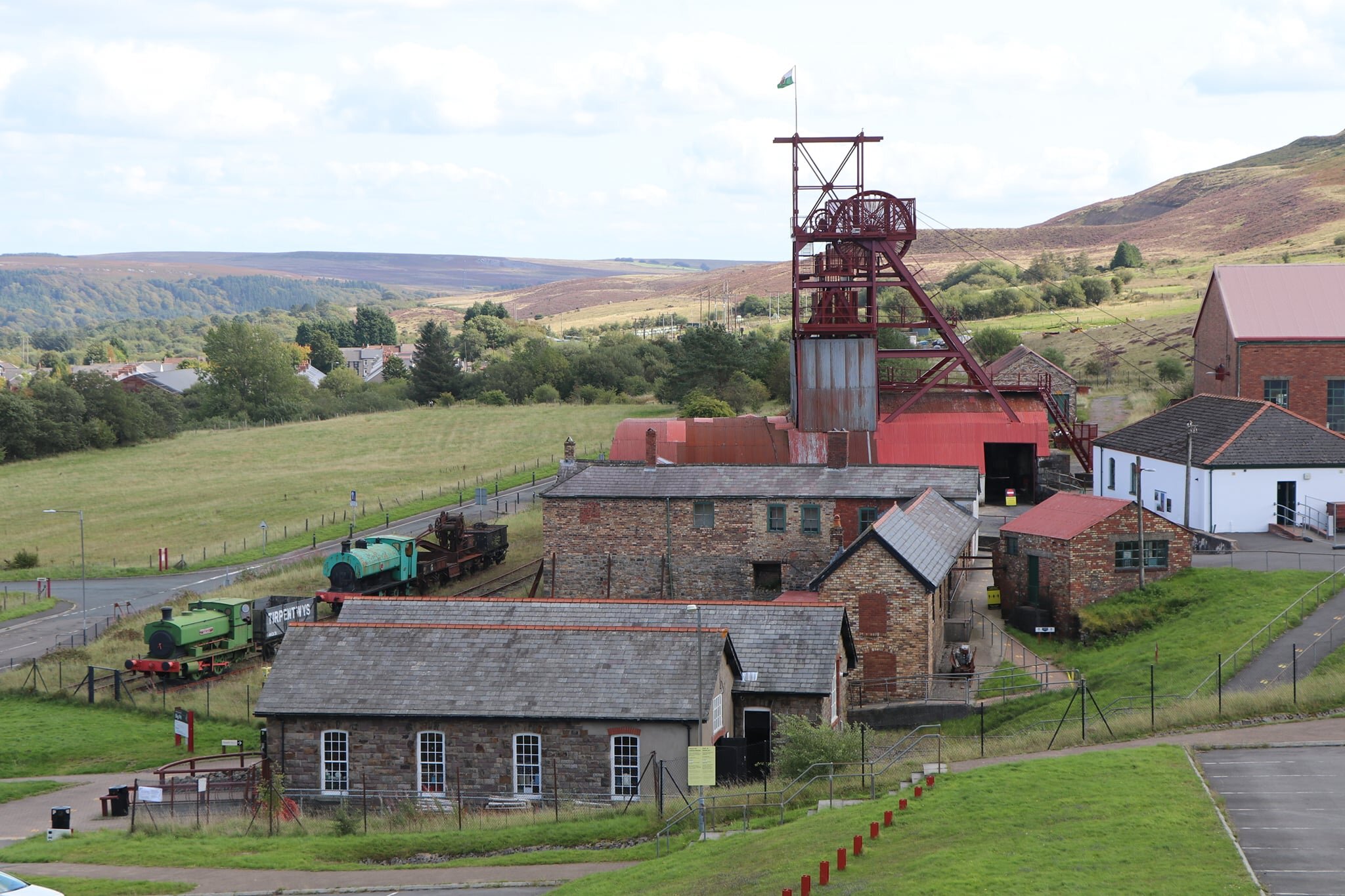
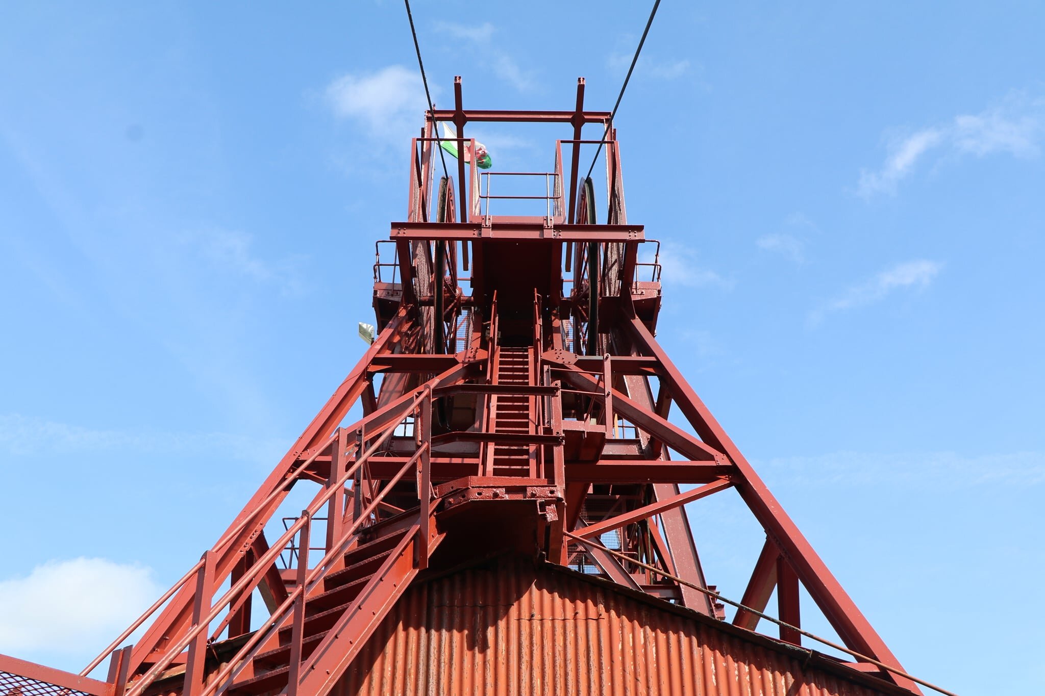
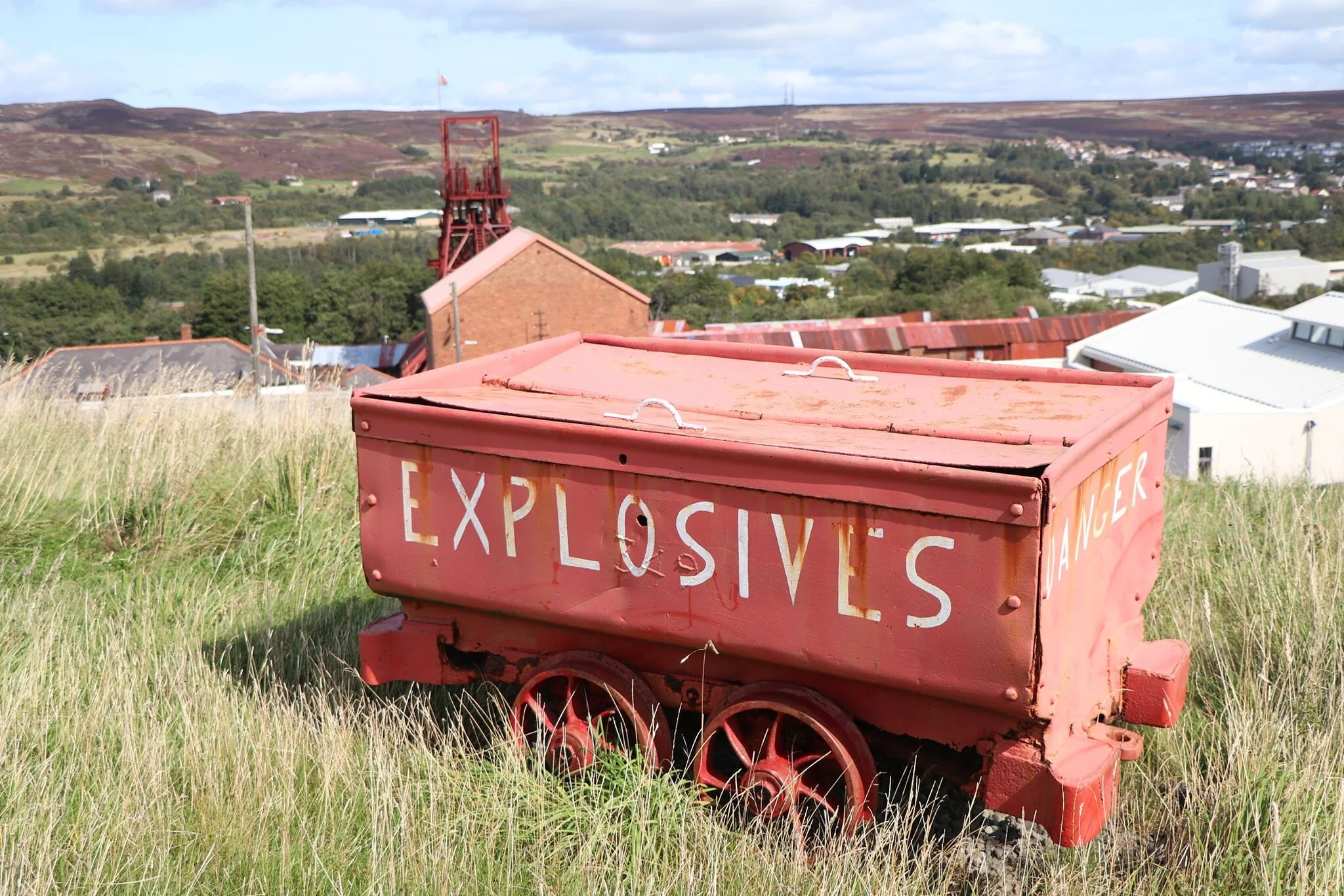
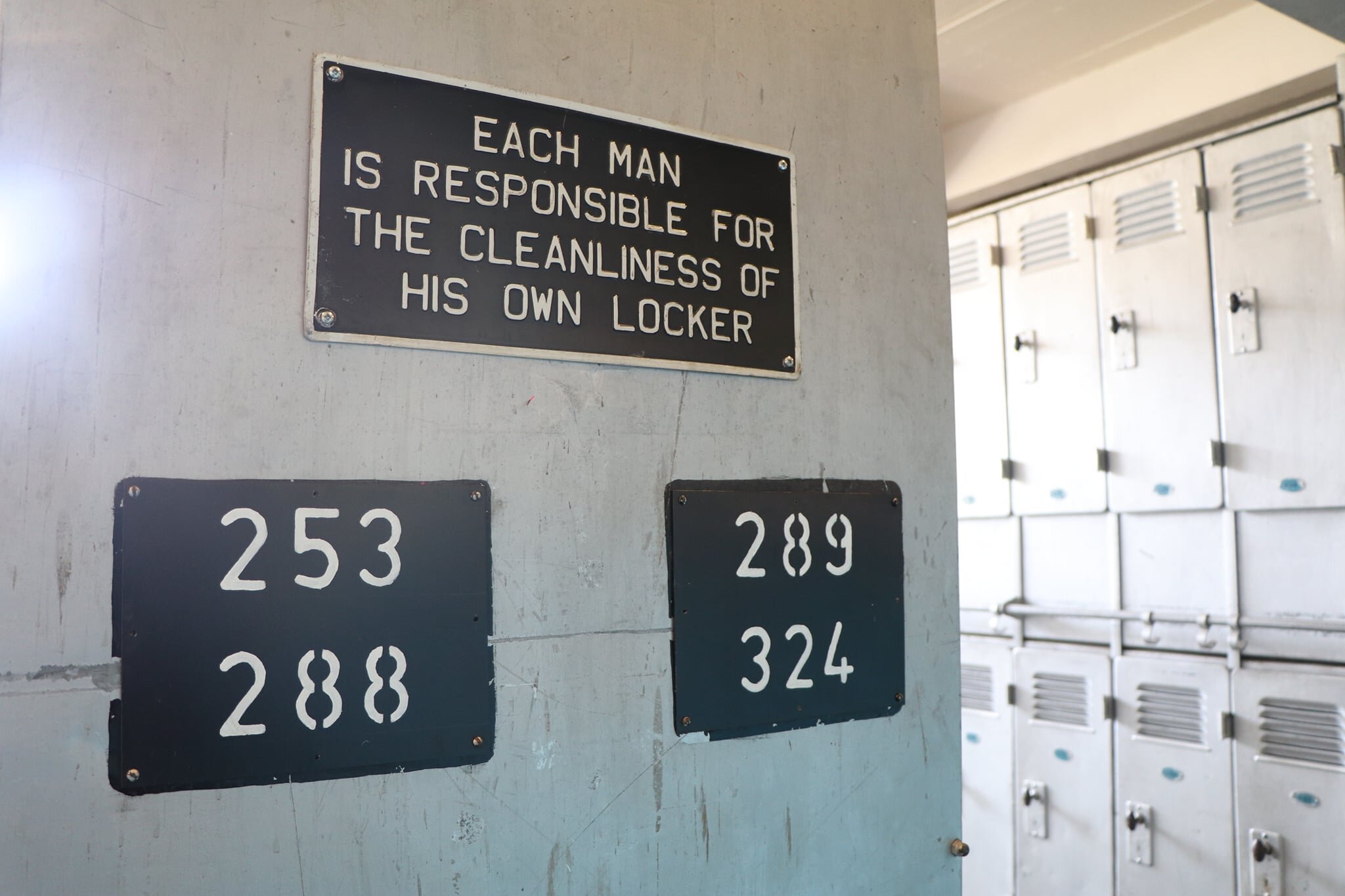
First up was the Big Pit National Coal Museum. The Big Pit was a working coal mine until it closed in 1980, subsequently reopening as a museum. It’s now part of the National Museum Wales.
Of all the places I visited, the Big Pit has been the hardest hit by the coronavirus restrictions, as their two big ticket attractions - the tour into the mine itself, and their mining experience gallery - are underground and unable to open safely. Nonetheless, it is a fascinating place, and as a national museum it has free entry, so you can hardly complain about being short-changed! I thought the galleries in the pithead baths were particularly well done, although the museum had gone a little overboard with the coronavirus fencing to keep people on their preferred path - some of it was not pretty and didn’t feel necessary. They could learn from the Ironworks about this (of which more later).
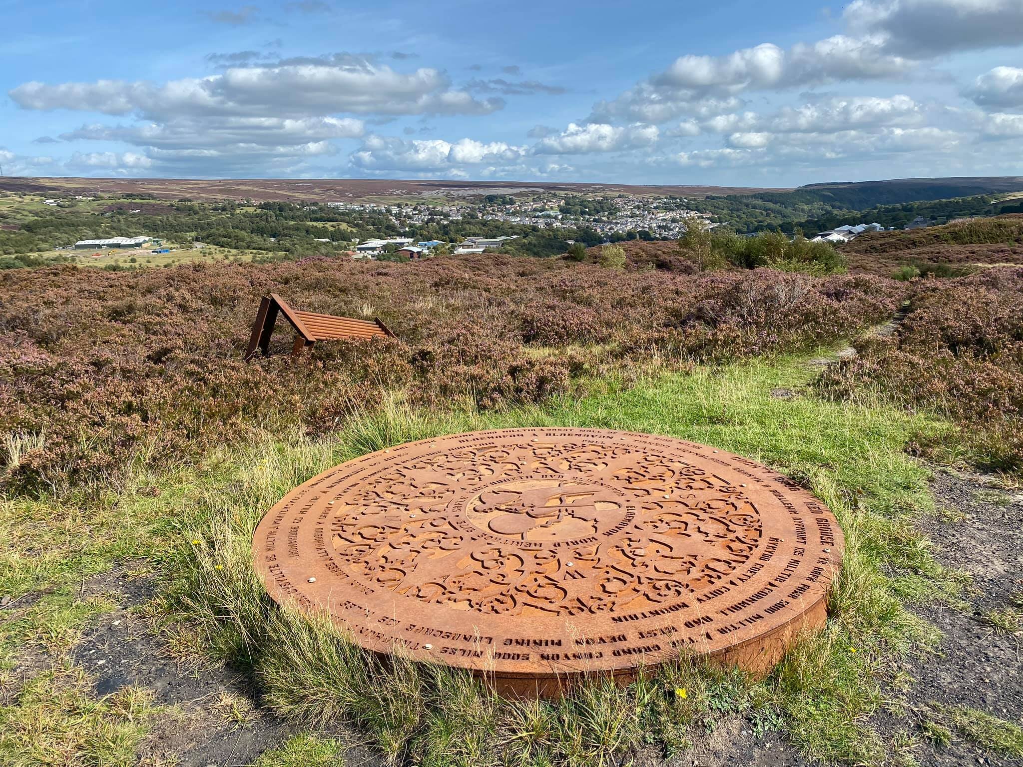
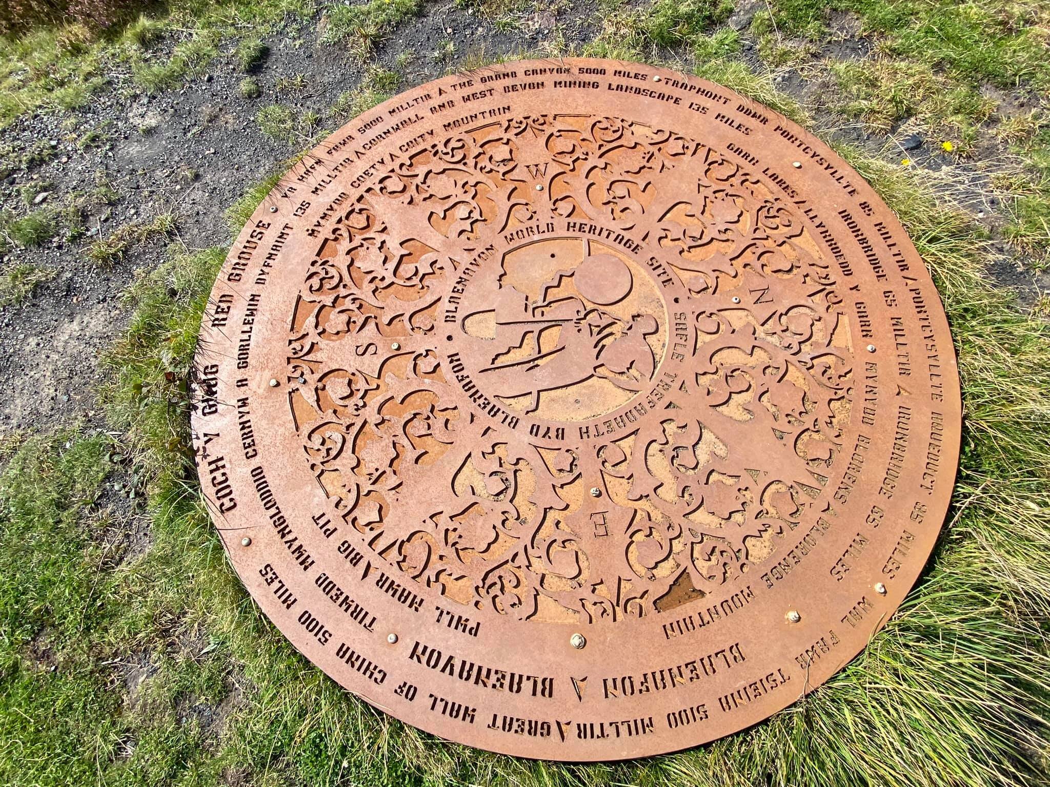
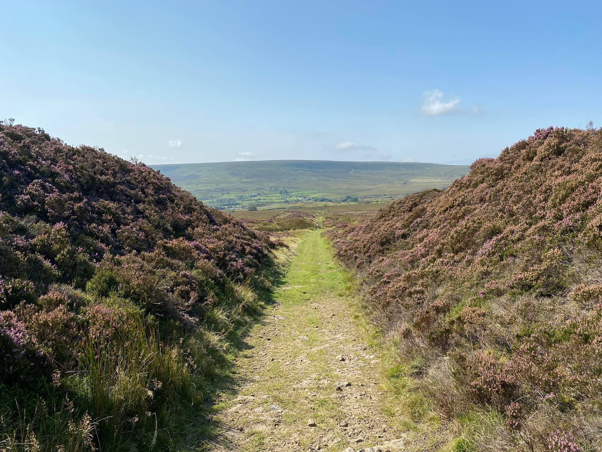
Not far from the Big Pit and adjacent to the railway line, I unexpectedly stumbled upon my first trail walk of the weekend, the Coity Tip Trail. A short nature walk only around 1km long, the trail winds around and then eventually over the spoil tip from the former Coity Pit, now largely reclaimed by the local flora and fauna. You can download a PDF leaflet which tells you more about the walk, but somehow manages not to mention the trail’s hidden secret. The two photos above show the magnificent Coity Tip topograph. I was mesmerised by it - the best example of a topograph I have ever seen. However, it’s not on the trail guide, and it’s not even on the trail route - you have to veer off to the left at the top of the heap. It must be an open secret but I was proud of my discovery nonetheless!
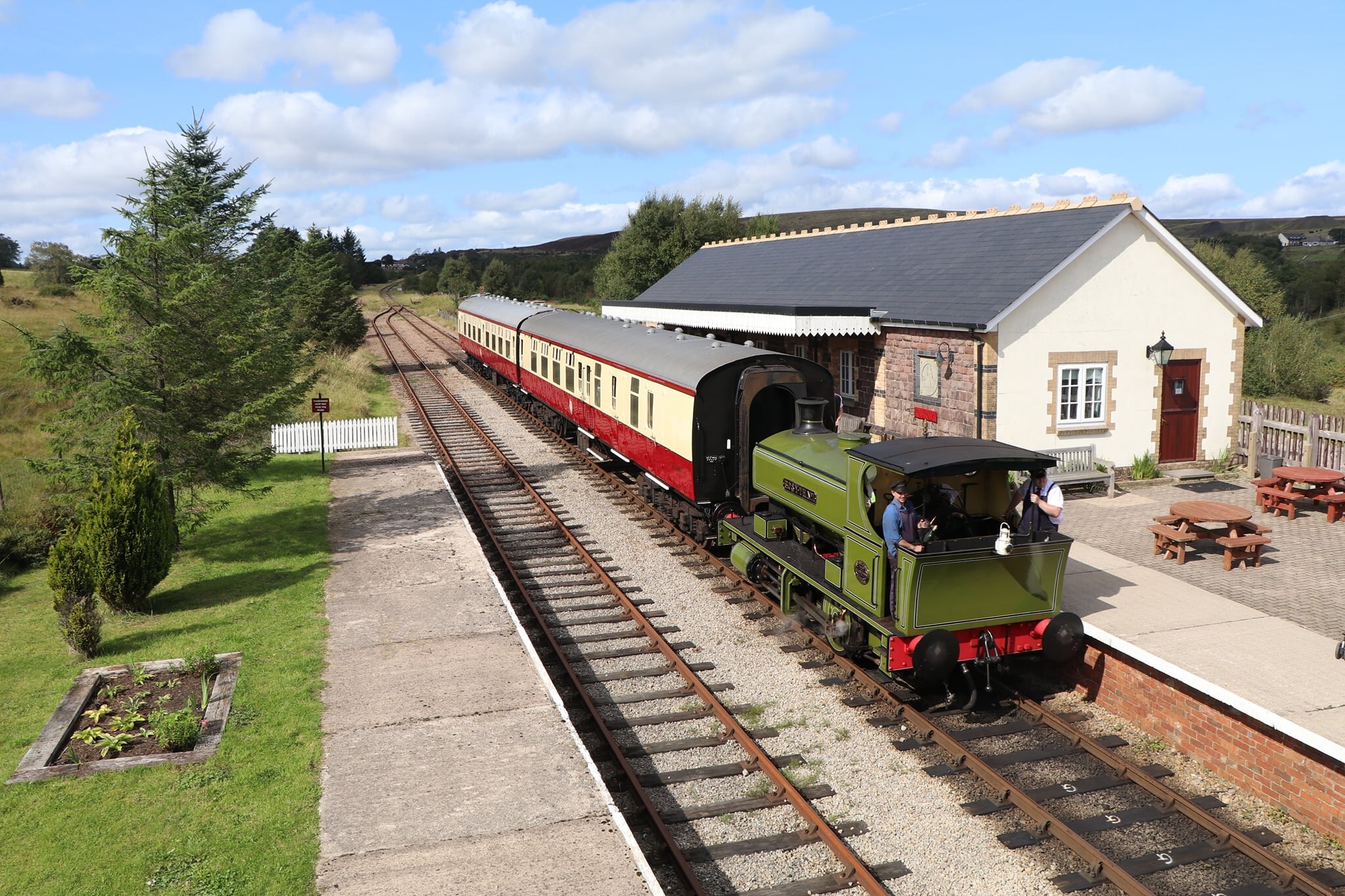
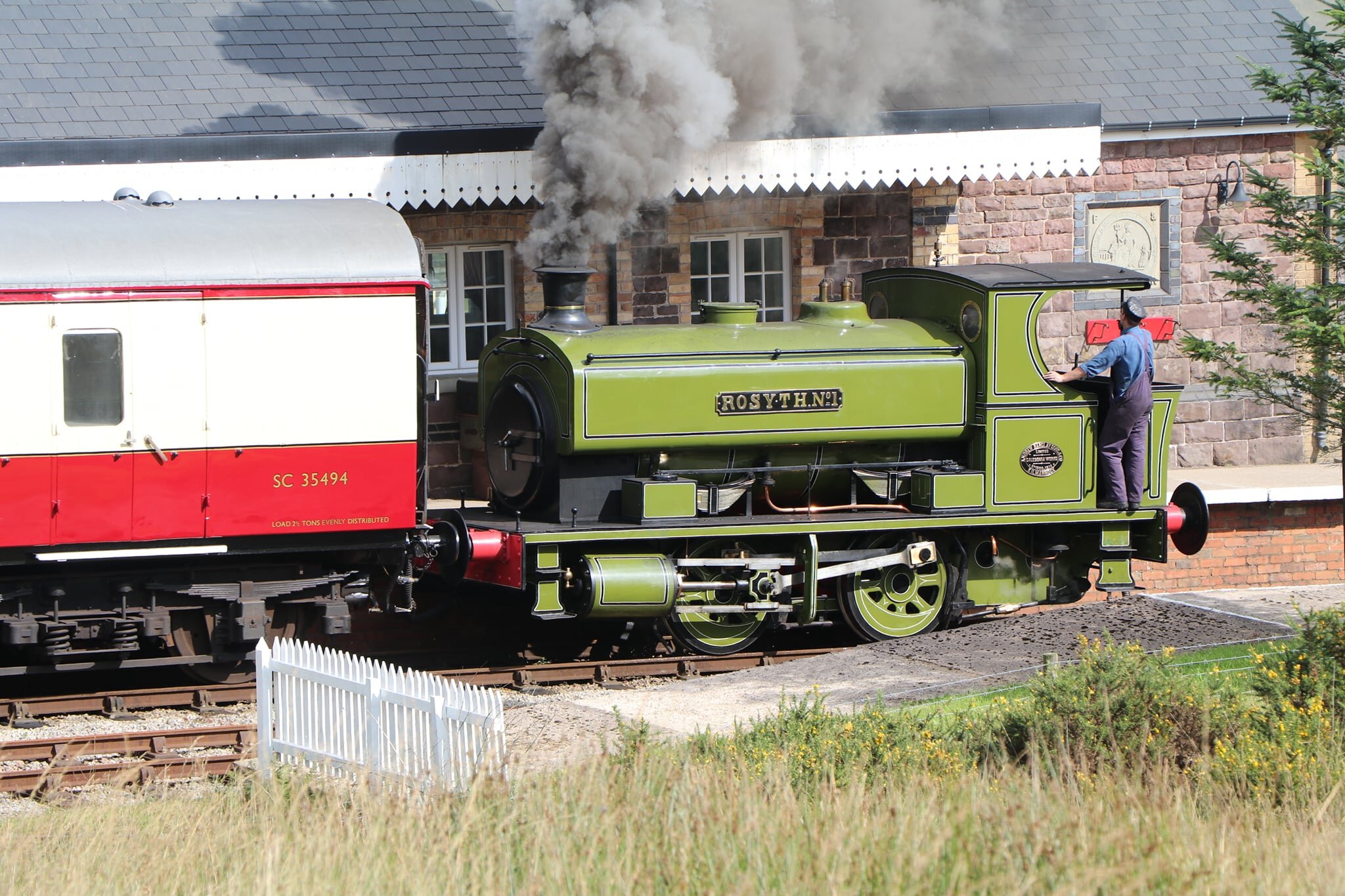
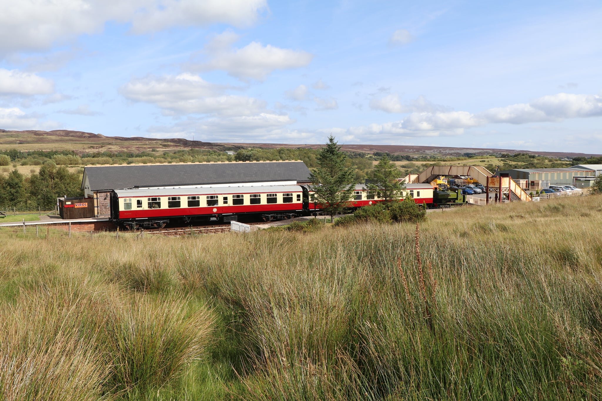
Blaenavon’s Heritage Railway runs through the heart of the industrial landscape for just under four miles. Even when you can’t see it, if the train is running you can almost certainly hear the distinctive whistle and chug of a tank engine echoing down the valley!
Due to coronavirus restrictions, the railway is currently only selling tickets for full compartments and round trips. This would be great value for a large family but makes it prohibitively expensive for a solo traveller. Nonetheless with several of the walking routes running parallel to the track, it isn’t difficult to catch a good view of the train going past. One thing I did notice - the railway is absolutely spotless. The first picture above of Furnace Sidings station looks like a model railway!
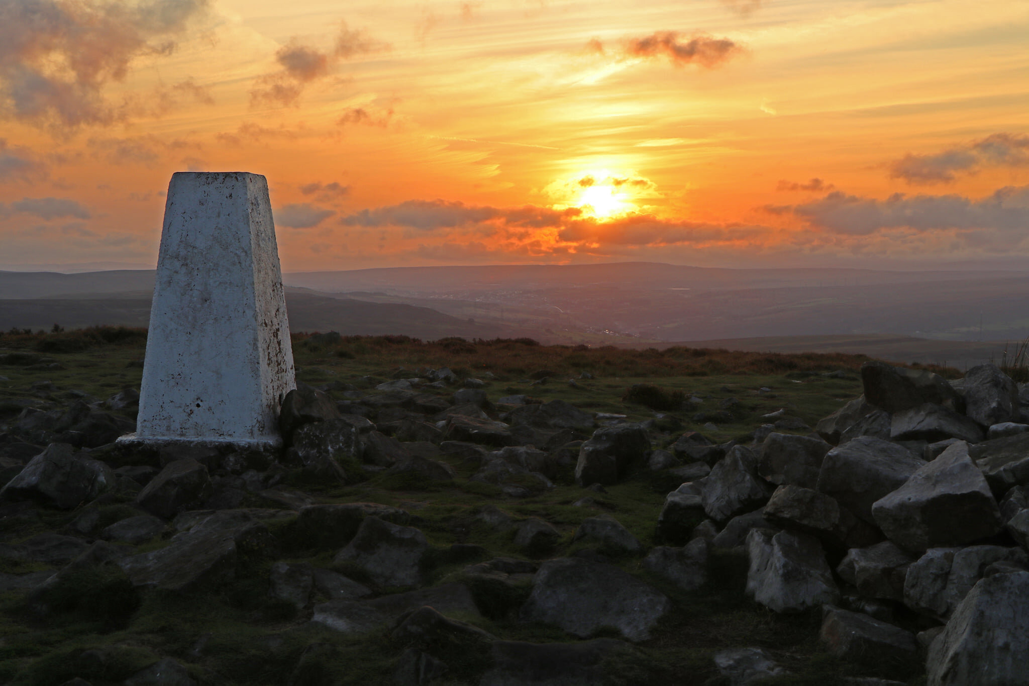
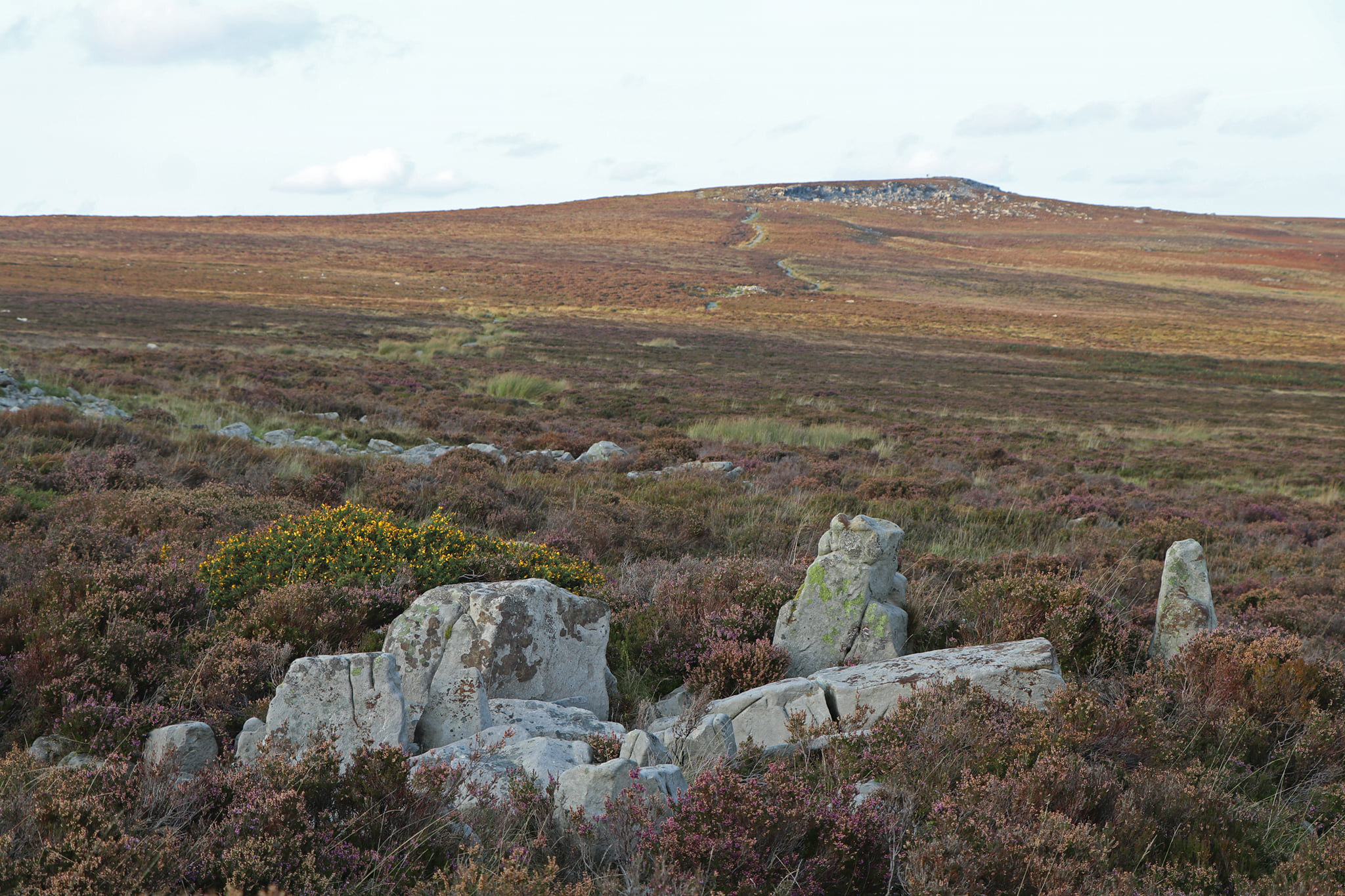
With most of Blaenavon already at well over 300m above sea level, the slopes of the Blorenge appear as rolling moorland to the north and north-east of the town, and the 561m summit is largely out of view. With the weather well set, it seemed like a great opportunity for a sunset hike.
For some reason, my brain continues to want to call it the blancmange - and to be fair there are some similarities. Both are rounded and shapely, and are relatively flat and soft on top!
The steepest parts of the climb are in the town itself, so once you've left civilisation behind, gently rising (and occasionally soggy) moorland and heather is all that remains. At 508m, you rediscover the road, at the Foxhunter car park (named after a show-jumping horse). From there, it’s a relatively straightforward amble across the moor to the summit, accessible for most levels of fitness.
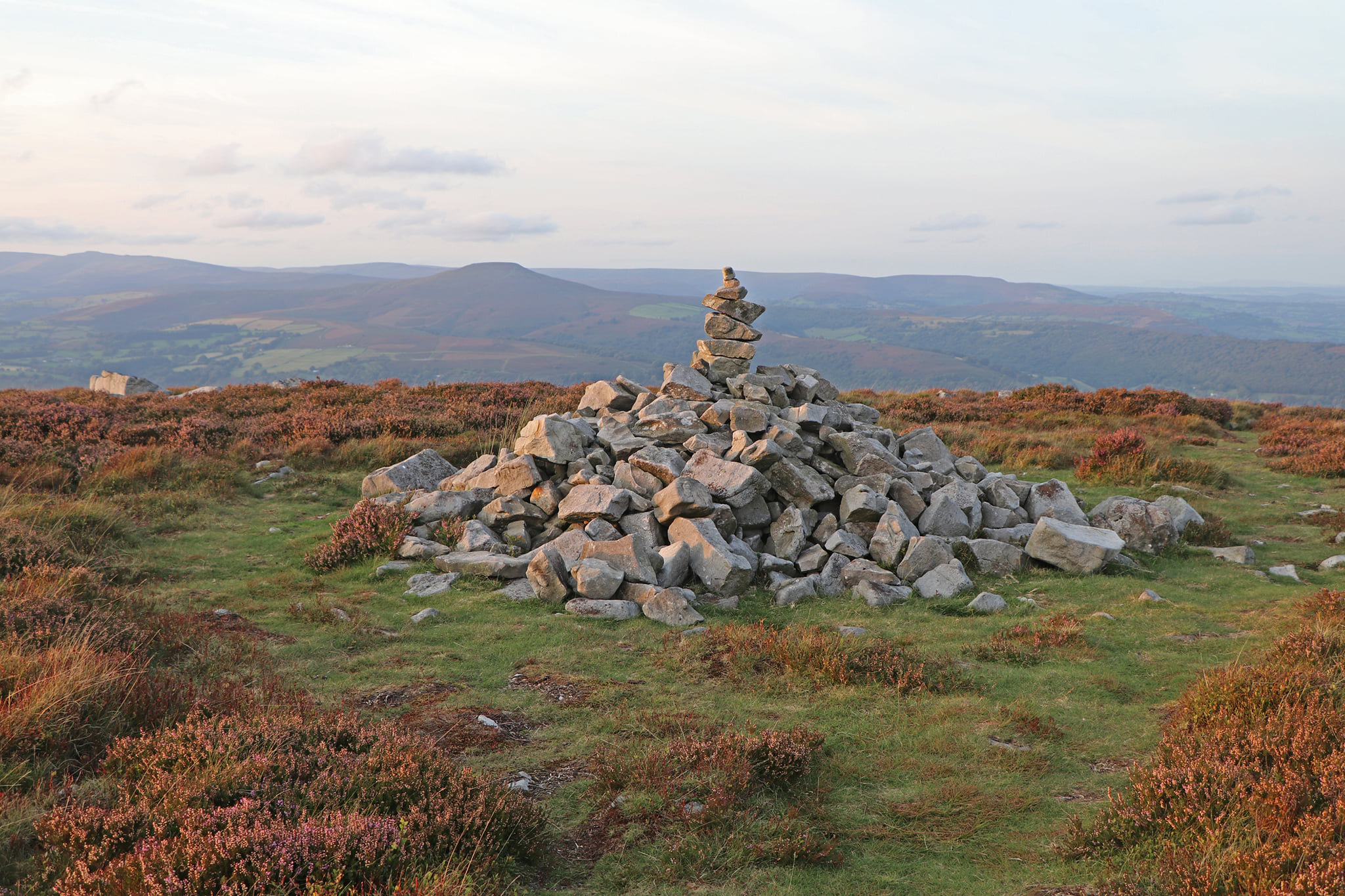
The Blorenge is actually part of the Brecon Beacons National Park, thanks to a strange geographical dog-leg that the park boundary takes across the Usk Valley, but it definitely does not feel out of place in a national park. Although the summit plateau takes the view back down into Blaenavon out of reach, between the summit and the slightly lower north top, there’s ample compensation with terrific views over to the Brecon Beacons themselves, the Black Mountains, the Sugar Loaf and Abergavenny town, and the fields of Monmouthshire.
I saw 90% of a spectacular sunset over the Brecon Beacons, with the inevitable cloud arriving over the summit of Pen-y-Fan at the most inconvenient moment. It was a gorgeous Saturday night, and the summit is only a mild amble from the car park - yet I was almost alone. As the sun fell, a mountain biker zipped past, and a local couple appeared just before sundown, but there was no-one else.
The hike up had been enjoyable and the sunset was spectacular, but the descent was a little more fraught. The plethora of paths led me to decide against chancing the open moorland in the fading light, which meant plodding down the side of the open road as the sunset turned to darkness. Suboptimal!
Fading light aside, this was a fabulous walk, and a great time of year to do it, as the heather starts to turn to rust. Regular readers will be aware of my love for the fells as they turn melon and orange.
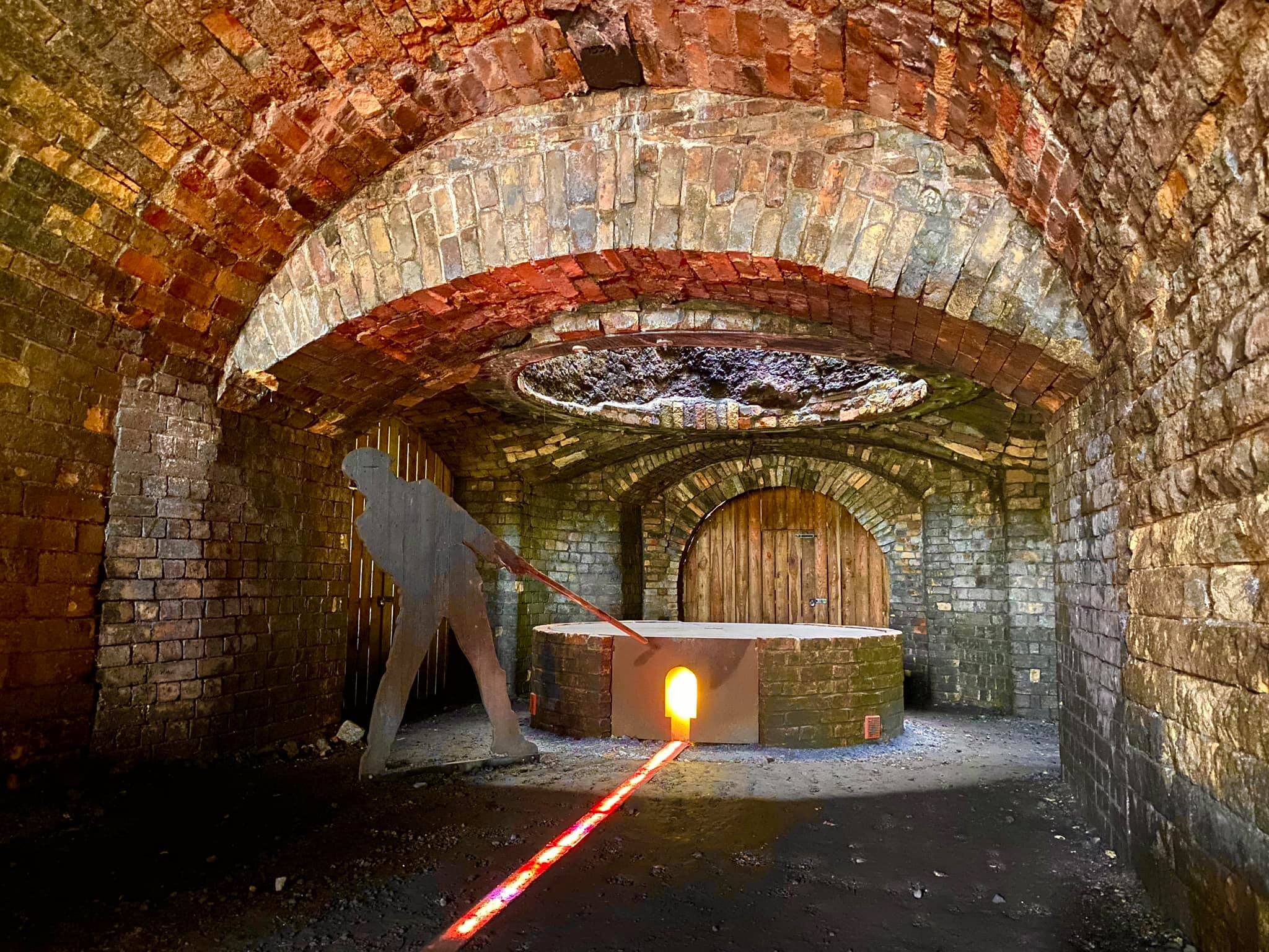
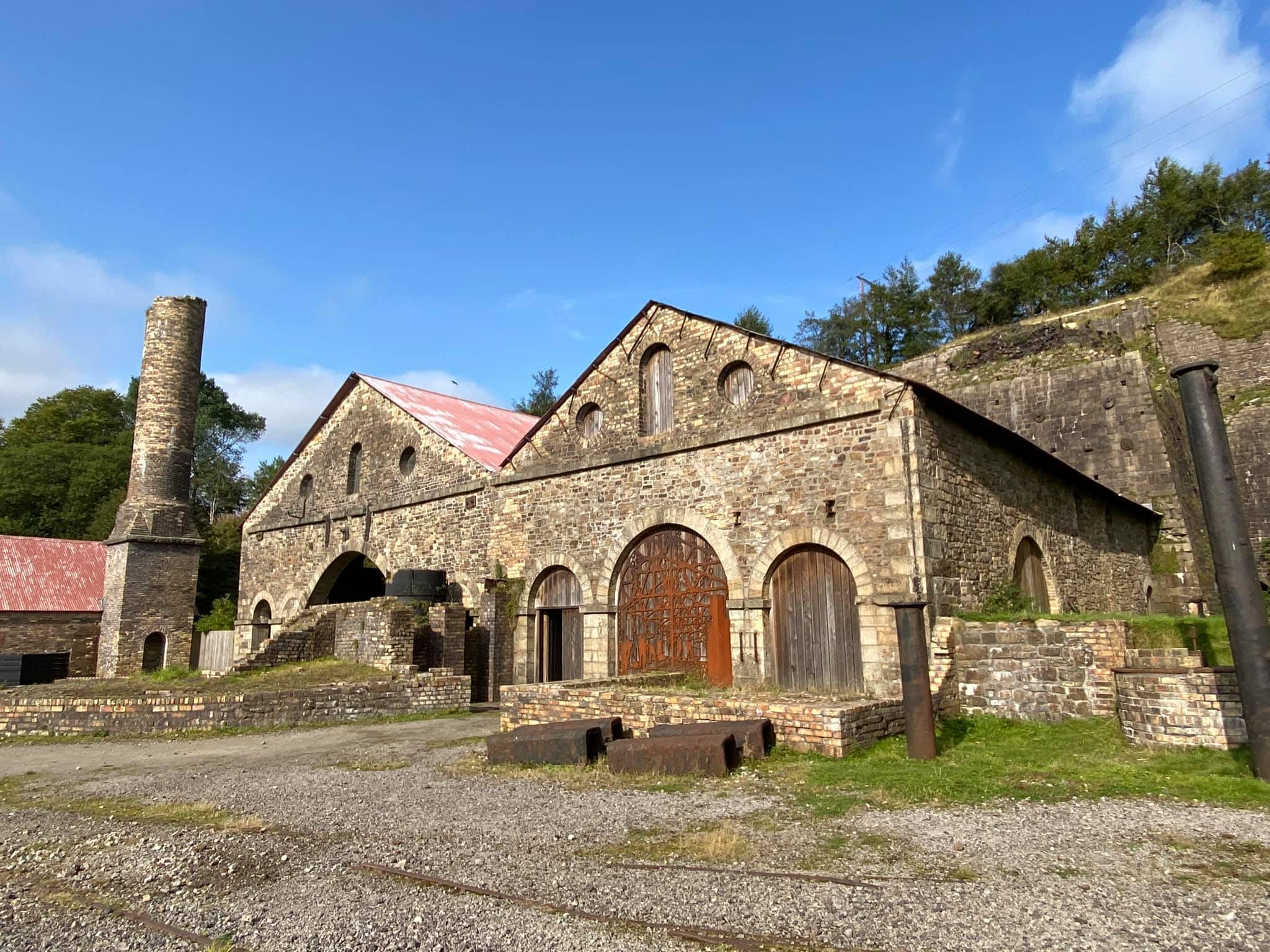
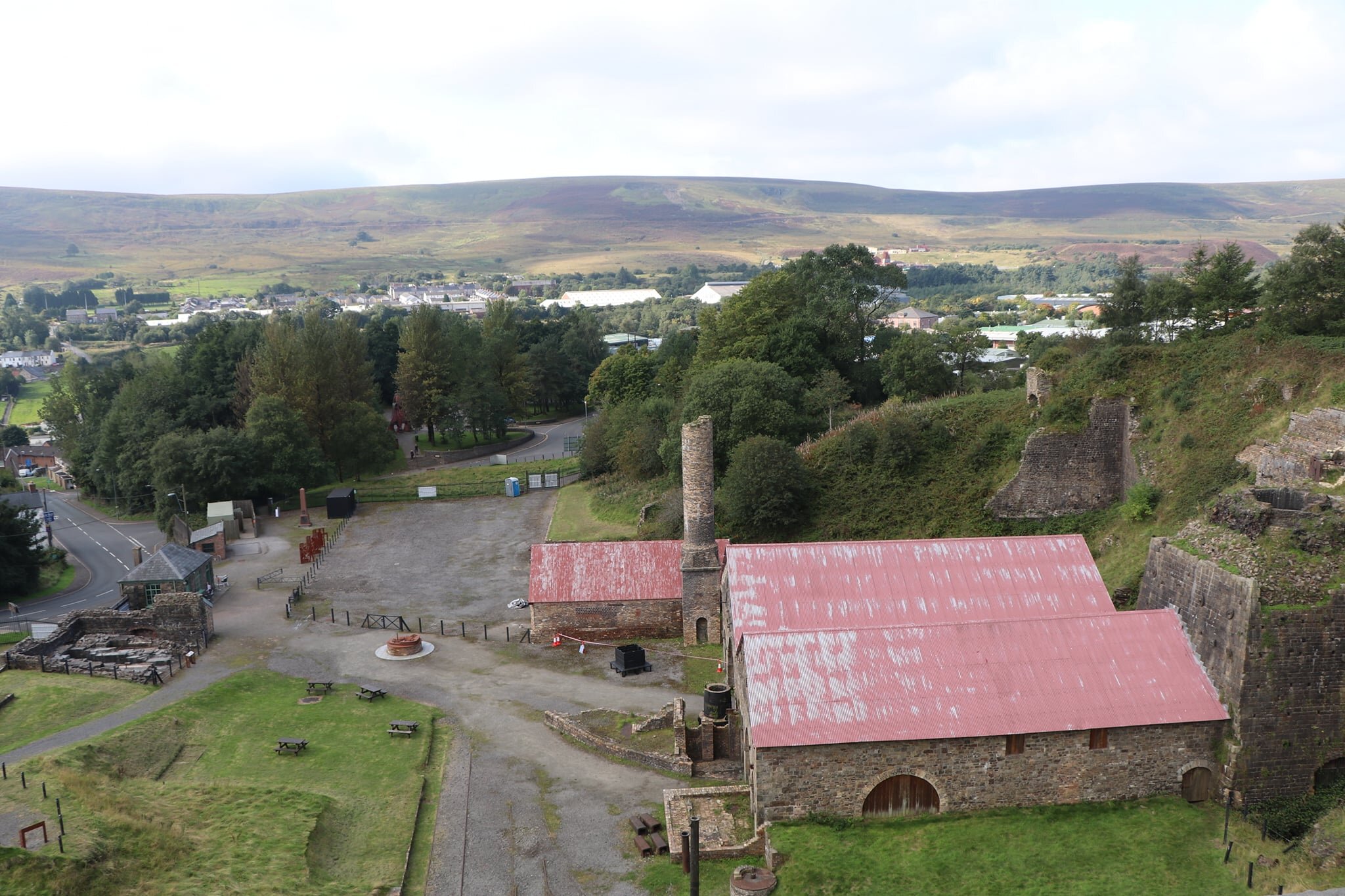
Like the Big Pit, the Blaenavon Ironworks are operating under reduced capacity to keep visitors safe from coronavirus, but they have been luckier in their layout, with 95% of the site open as usual - only the workers’ cottages are out-of-bounds, and even they can still be viewed through open doorways.
I thought the presentation in the former furnace building was brilliantly done, and although the site is not large, it always holds your attention. There’s also a great view over the town and the valley from the top of the balance tower, although it does require some head for heights!
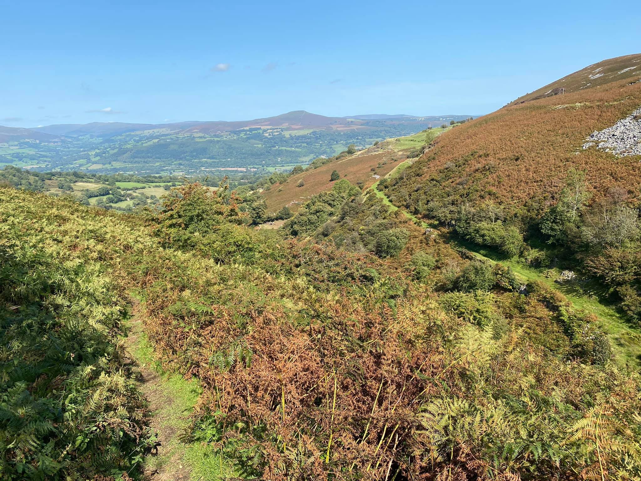
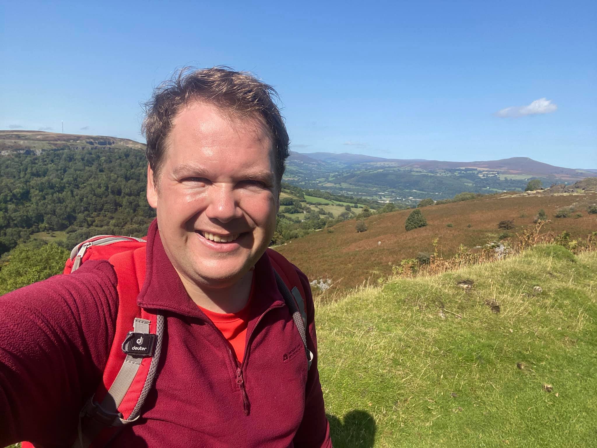
So, time for the big hike finale! The Iron Mountain trail comes in two flavours - a seven mile hike to the north of Blaenavon, and a five mile circular to the north-west. Having already visited the Blorenge summit, which covered a chunk of the first section of the trail, I opted to combine much (although not quite all) of what remained from the two parts into one larger hike. I’d got to Blaenavon by train to Cwmbran and then bus up the valley, but to save myself from doubling-back (and to give me enough time to get home) I would wander around the mountain and descend into Abergavenny where I could pick up the train home.
The trail route bypasses the Garn Lakes Nature Reserve but I made a short detour to take a look, before turning north onto the Dyne-Steel Incline path. Although this becomes a stone trail further up the incline, at the bottom it involved an unexpected traverse of an iron-soaked bog. I made it across, but at the cost of my legs looking like they’d had a really terrible fake tan applied. The incline descends into the Pwll Du hamlet. The trail map (and my OS Map) both advertise a pub here, but it has long since been converted into a private dwelling.
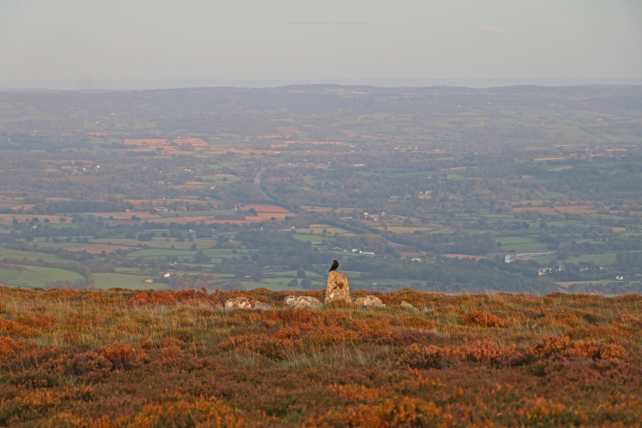
I continued north around the head of the valley, with the view opening up over the Usk Valley ahead. You cross the road at Garn Ddyrys, where there is precious little left of the giant foundry and forges that used to occupy the site. From here, Hill’s Tramroad follows the contour around the slopes of the Blorenge, offering great views over the Usk, the Sugar Loaf, and over to the Black Mountains.
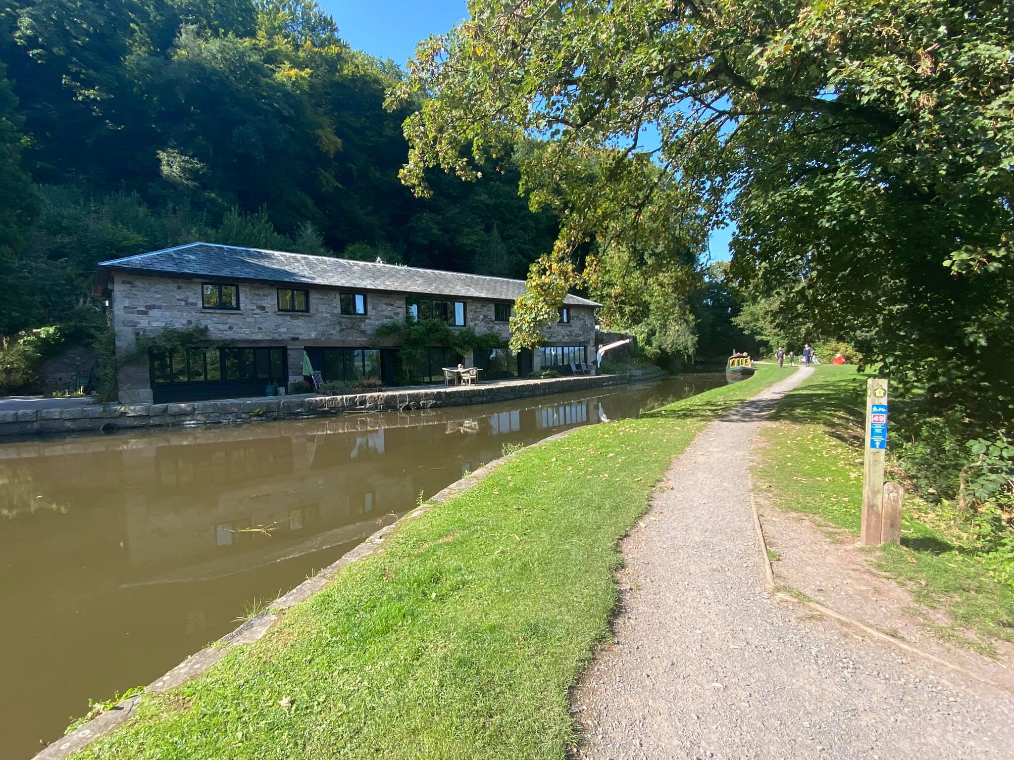
From here, the trail returns to Blaenavon, continuing around the east of the Blorenge before diverting up to the summit. I descended through the woodland to Llanfoist, stopping briefly at the Wharf there to look at the Monmouthshire and Brecon Canal. It’s a nice spot, especially if you’re staying in one of the Wharf buildings, all of which seem to have been converted into holiday lets.
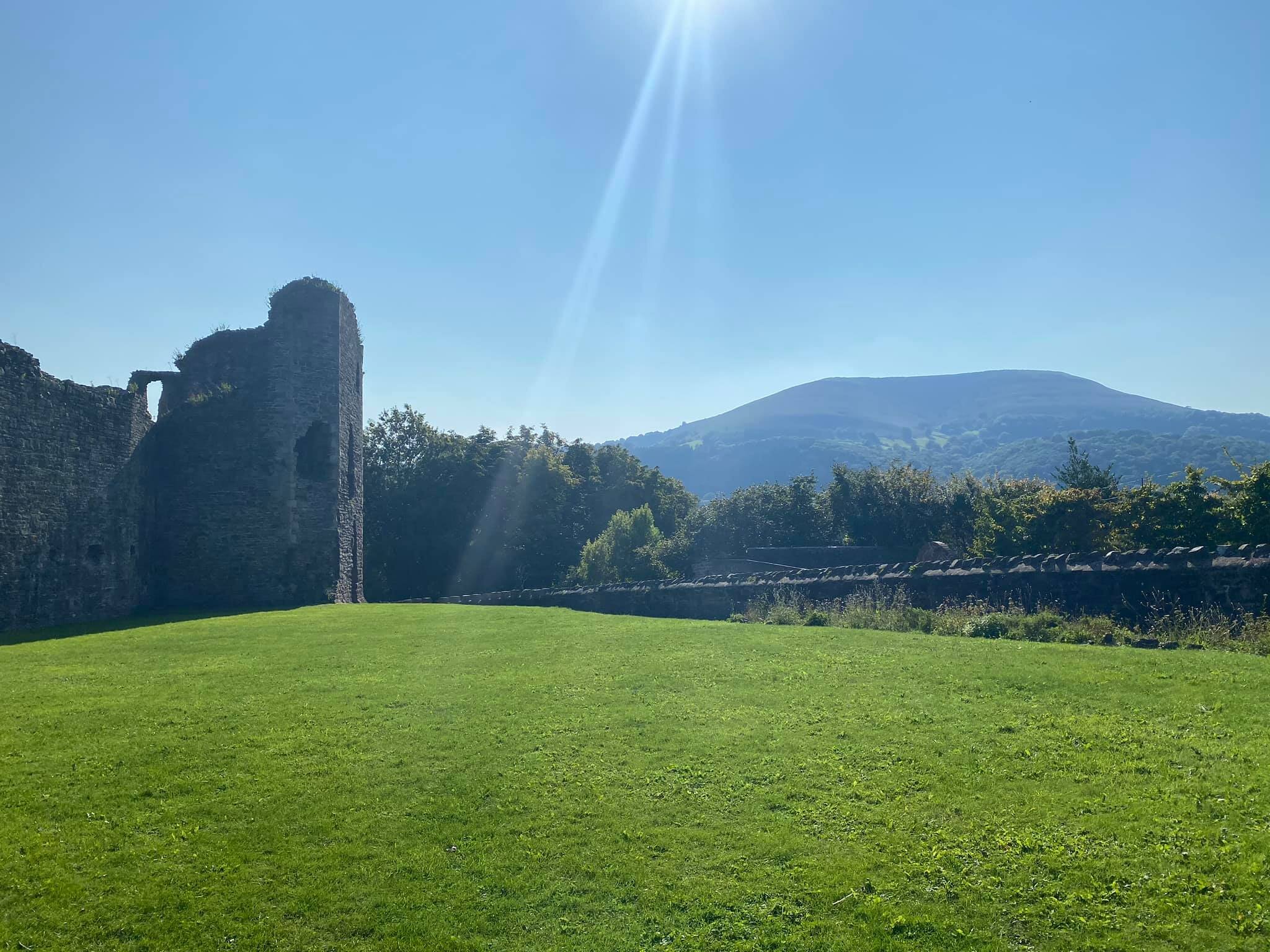
From Llanfoist, it’s a flat valley walk into Abergavenny, across the lovely old bridge and through Castle Meadows. I didn’t have time to sample the delights of Abergavenny other than a few minutes to peruse the castle grounds. From here, you see the other side of the Blorenge, standing tall and imposing itself over the town and valley.